June 26, 2023 | Remote Sensing of Environment
A research team comprising experts from South Dakota State University, the USDA, California State University Monterey Bay, and the University of Maryland has pioneered an advanced algorithm for real-time monitoring of crop development at the field level. They've achieved this by harnessing the power of various satellite data sources.
The challenge they addressed is the lack of timely, cloud-free satellite data to monitor crop growth as it happens. To overcome this, they've devised a novel algorithm that blends information from high-resolution satellites (Landsat and Sentinel-2) and geostationary satellites (which take frequent snapshots) to create uninterrupted time series data for assessing crop health.
What makes this algorithm unique is its ability to not only analyze current conditions but also predict how crops will progress. It uses information from previous years to anticipate future growth. This comprehensive system enables the identification of key stages in a crop's life cycle, such as when it starts to grow, matures, or goes dormant.
The real-time monitoring process is divided into three categories: near-real-time (detecting events shortly after they happen), real-time (identifying events as they occur), and short-term prediction (forecasting events before they occur). These predictions are continually updated every week throughout the growing season.
To validate the system, they compared their real-time predictions with established phenology methods, PhenoCam observations, and official Crop Progress Reports. The results demonstrate the algorithm's reliability, particularly in predicting when crops start growing in spring and when they go dormant in winter.
This innovation has the potential to revolutionize agriculture by providing farmers with timely and precise information about their crops, ultimately helping them make informed decisions for better yields and more efficient resource use. It's like having an advanced crop advisor available around the clock.
Read more: Developing an operational algorithm for near-real-time monitoring of crop progress at field scales by fusing harmonized Landsat and Sentinel-2 time series with geostationary satellite observations
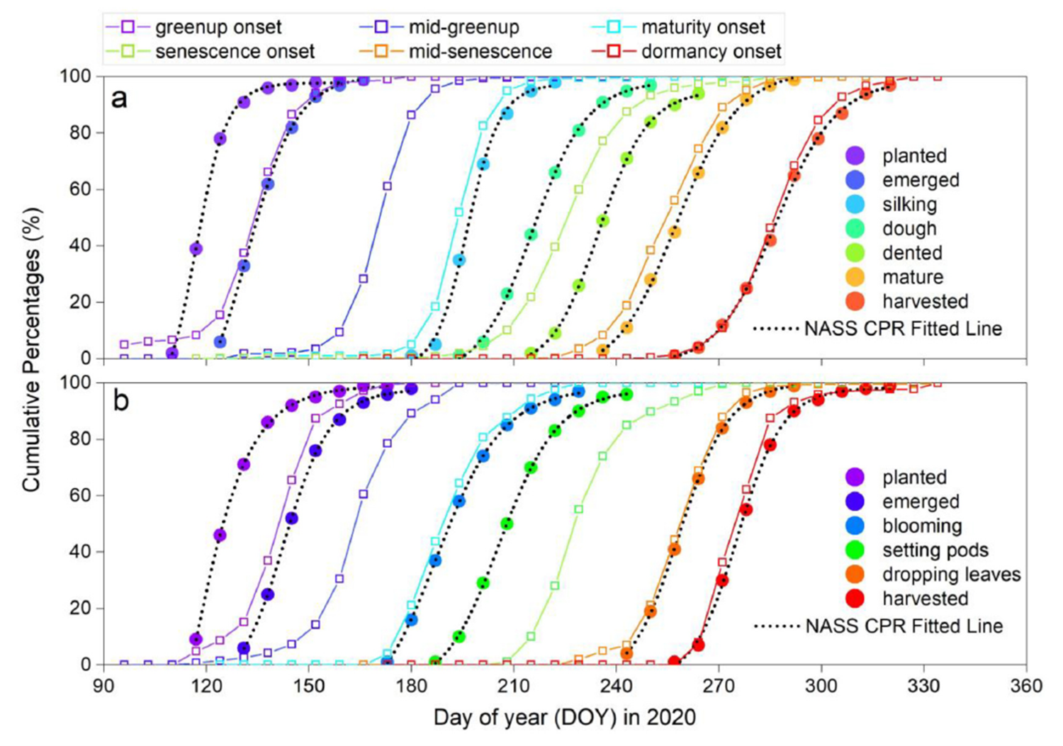
Fig. 9. Comparisons of NASS CPR (solid circles) with HLS-ABI real-time predictions (hollow rectangles) for (a) corn and (b) soybean across Iowa in 2020. Note that the black dotted lines are fitted lines using logistic function.


