July 15, 2023 | Science of The Total Environment
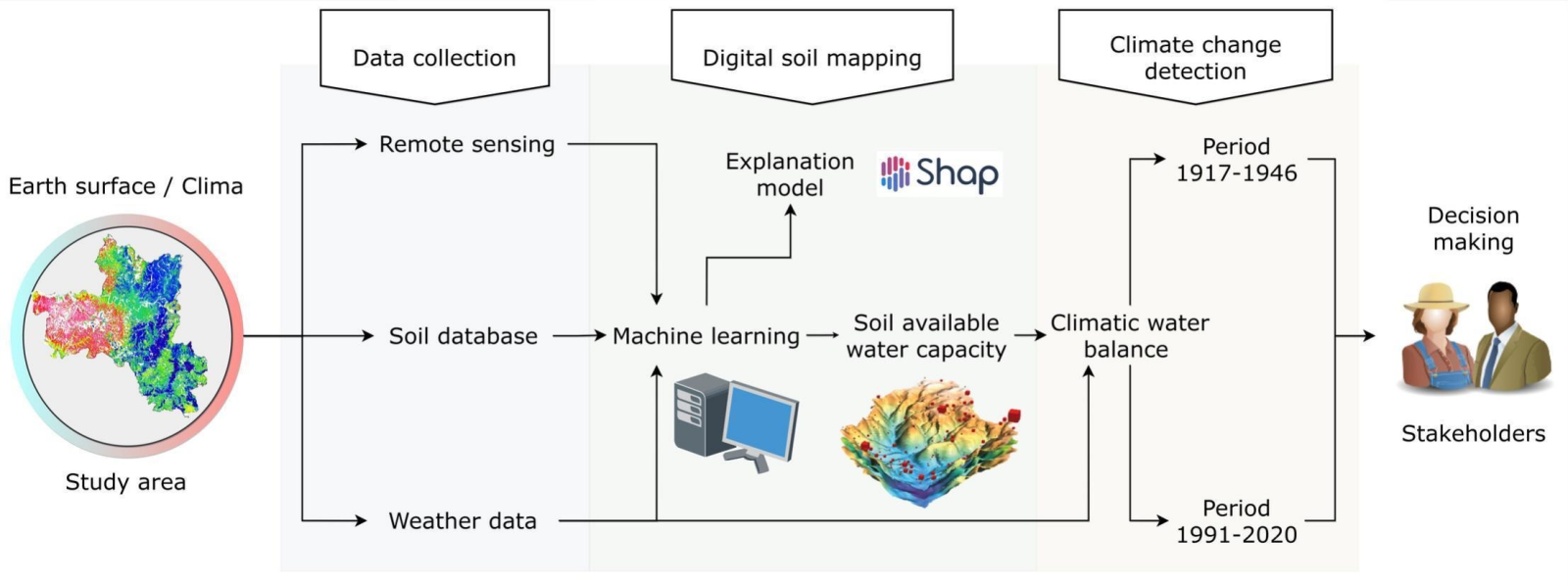
Soil plays a crucial role in agriculture, but understanding its water-holding capacity, called available water capacity (AWC), can be challenging. Traditional methods for measuring AWC are labor-intensive, and creating detailed maps of AWC across a region is complex. To tackle this, researchers from the University of São Paulo in Brazil explored digital soil mapping (DSM) techniques, which use computers to predict AWC.
In their study, the team focused on the AWC in a southeastern region of Brazil. They collected data from various sources, including soil samples, remote sensing data, and weather information. The heart of their approach was a powerful algorithm called Random Forest (RF), which helped them create digital maps of AWC. These maps can be valuable for planning agriculture, especially in the face of local climate changes.
The study had two main parts. First, they used their data to develop a digital AWC map, and in the second part, they used this map alongside historical weather data to calculate how soil water levels changed over time. The results were promising, with the digital model accurately predicting AWC levels.
One exciting finding was that certain factors, like temperature and soil type, had a big impact on AWC. For example, during the dry season (from April to August), the soil could hold more water due to specific temperature patterns.
Overall, this research offers a practical way to understand and map soil water capacity, providing essential information for farmers to adapt their crop schedules to changing local climates, ultimately making agriculture more resilient.
Read more: Digital mapping of the soil available water capacity: tool for the resilience of agricultural systems to climate change
Graphical Abstract


