Remote Sensing | Apr 15, 2023
Crop phenology, the study of plant development stages, plays a vital role in predicting crop yields. A recent study conducted by researchers from Katholieke Universiteit Leuven and others in Belgium investigated the effectiveness of satellite sensor data in detecting these stages compared to field observations and proximal sensing.
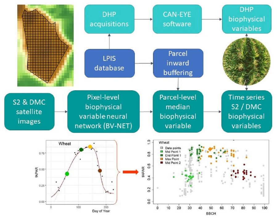
The researchers analyzed data from winter wheat, silage maize, and late potato fields over a three-year period. They found that the spectral signals obtained from different sensors, including Digital Hemispherical Photographs (DHP), Disaster Monitoring Constellation (DMC), and Sentinel-2 (S2), were specific to each crop and independent of the sensor used.
Models based on the fraction of absorbed photosynthetically active radiation (fAPAR) derived from sensor data showed better accuracy in fitting the observed data compared to the fraction of vegetation cover (fCover). Maize had the best model fit, followed by wheat and potato. The S2-derived fAPAR exhibited reduced variability as the growing season progressed.
The researchers also developed a double sigmoid model that accurately identified key phenological stages such as stem elongation, senescence, canopy closure, flowering, and fruit development. Increasing the frequency of sensor revisits proved beneficial for detecting short-duration phenological stages.
These findings have implications for improving crop yield forecasting and agri-environmental modeling through data assimilation, ultimately aiding in better decision-making for sustainable agriculture practices.