Remote Sensing | February 25, 2023
Soil properties play a crucial role in determining the potential for food production in a region. However, soil characteristics can vary significantly within a single plot, making it challenging to accurately map soil diversity using traditional methods. In this study conducted by the Institute of Soil Science and Plant Cultivation in Poland, researchers explored the use of Sentinel-2 multispectral satellite images to improve the quality of soil-agriculture maps.
The researchers formulated a hypothesis that high-resolution satellite images, combined with spatial and temporal analysis, can enhance the accuracy of large-scale soil-agriculture maps. They focused on maize as a case study and utilized specific terms related to maize development stages and vegetation indices to differentiate soil conditions, particularly in relation to water retention during drought periods.
The findings confirmed the hypothesis, demonstrating that remote sensing techniques significantly improved the level of detail in soil-agriculture maps. The results represent an important initial step towards developing a comprehensive model for detailed soil-agriculture mapping in Poland, enhancing the accuracy of drought monitoring systems.
This research contributes to the advancement of remote sensing applications in agriculture, enabling more precise assessment and monitoring of soil conditions, and ultimately aiding in sustainable agricultural practices.
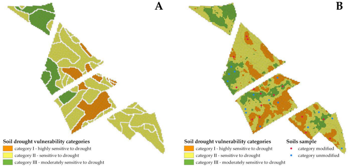
Drought vulnerability polygons of soils before reclassification (A), after reclassification with soil sampling locations (B).


