Search
Going back to grassland? Assessing the impact of groundwater decline on irrigated agriculture using remote sensing data
Sources of information

Remote Sensing | March 21, 2023

Climate change has increased the risk of agricultural drought in arid and semi-arid regions worldwide. To adapt, farmers often shift to more drought-tolerant crops or permanently switch back to grassland. Understanding the impact of declining groundwater levels on this decision-making process is crucial. Researchers from New Mexico Tech conducted a study in Union County, New Mexico, to explore how groundwater level decline affects the propensity of cropland switching back to grassland.

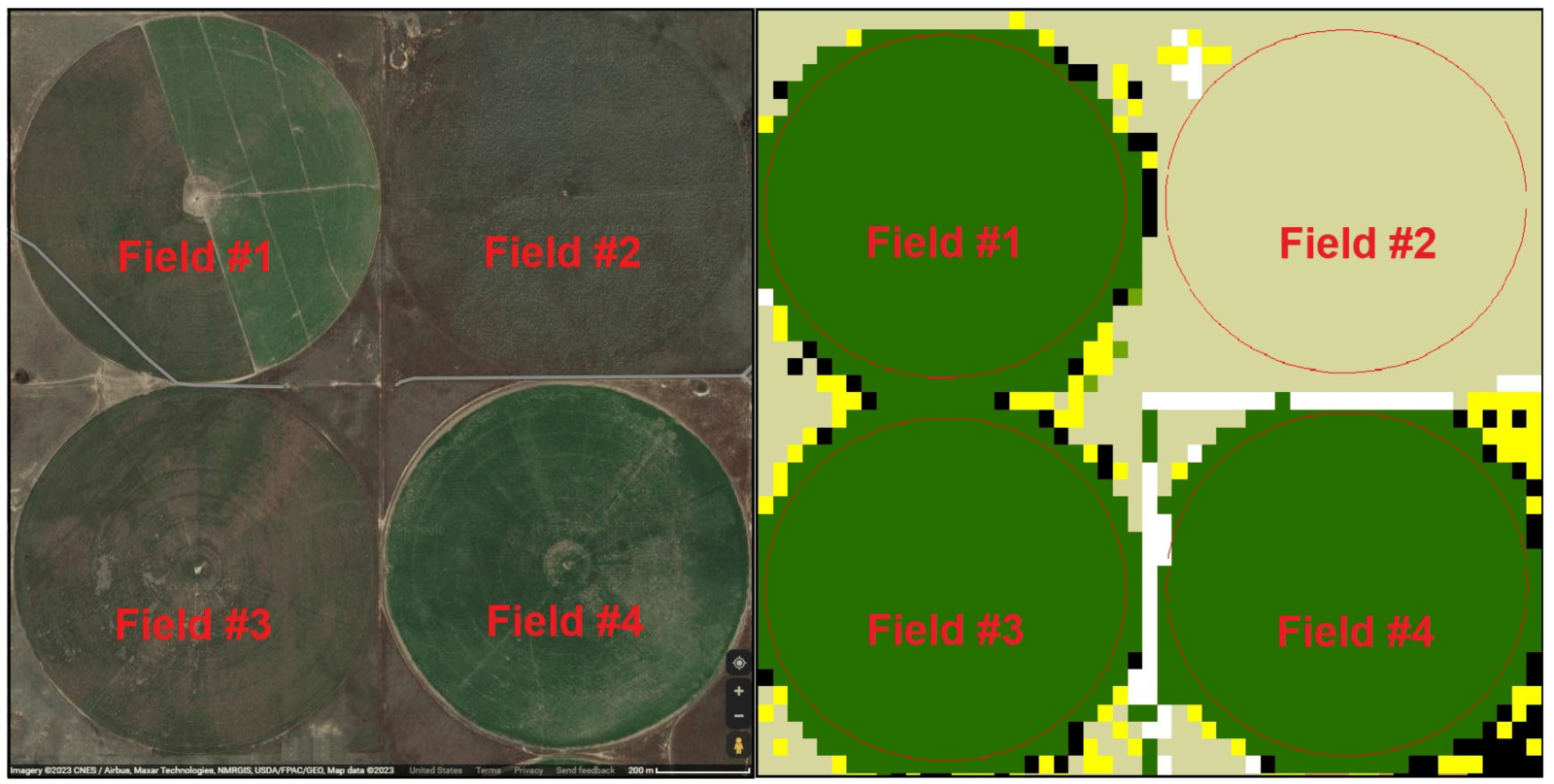
The study integrated field-scale groundwater level projections and high-resolution remote sensing data on crop choices. Using a regression analysis framework, they found that as the groundwater level in the Ogallala Aquifer declined, cropland in the area gradually and permanently shifted back to grassland. For every one-standard-deviation decline in groundwater level, there was an average 1.85% increase in the likelihood of switching back to grassland, which is a natural carbon sink.

The findings consider the fact that farmers explore other options before permanently switching back, such as growing more drought-tolerant crops or implementing land idling and rotation. The study concludes by discussing the policy implications for long-term land and water conservation.

This research provides valuable insights into the effects of declining groundwater levels on agricultural practices, helping inform sustainable land and water management policies in drought-prone regions.

*
A standard 400 m radius irrigated field (field #2) in its transition into grassland (left panel) compared to the remotely sensed Crop Data Layer (right panel, 2019 data) of the same location. Data Source: NASS, USDA; Google Maps. Note: The remote sensing data in the right panel indicate that corn (in dark green) was grown in fields #1, #3, and #4 in 2019. Later, in 2021 (corresponding to the time of the left panel Google Maps imagery), field #3 was in idle status and fields #1 and #4 still had corn.


Viewed Articles
Going back to grassland? Assessing the impact of groundwater decline on irrigated agriculture using remote sensing data
Remote Sensing | March 21, 2023Climate change has increased the risk of agricultural drought in arid and semi-arid regions worldwide. To adapt, farmers often shift to more drought-tolerant crops or pe
Read More
Smart breeding driven by big data, artificial intelligence, and integrated genomic-enviromic prediction
November 07, 2022 | Molecular Plant |  Introduction: Climate change and population growth necessitate a transition from traditional phenotypic selection to data-driven "smart breeding". A research tea
Automated Tomato Fruit Detection for Efficient Harvesting
August 26, 2023 | Plants | Introduction: A recent collaborative study by National United University, Taiwan, and HCMC University of Technology and Education, Vietnam, addresses the need for efficient
Prediction-based breeding: Modern tools to optimize and reshape programs
October 09, 2025 | Crop Science |  Introduction: Traditional plant breeding often prioritizes explanatory models to understand biological mechanisms, which can limit the generalizability of selection
An integrated approach of remote sensing and geospatial analysis for modeling and predicting the impacts of climate change on food security
January 19, 2023 | Scientific Reports |  Introduction: Climate change threatens agriculture, infrastructure, and local communities. Monitoring and predicting climate impacts on food security is essent
Enhancing Energy Efficiency of Greenhouses using AI-based Climate Control
February 28, 2023 | Advances in Applied Energy |  Introduction: Researchers from Cornell University in USA proposed the use of novel artificial intelligence (AI)-based control framework to enhance the
TOP